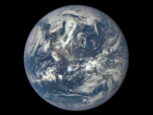
You can't call it "the dark side of the moon" based on a new NASA picture.
A camera on the Deep Space Climate Observatory (DSCOVR) satellite shot an arresting view of the moon crossing in front of the Earth. The image clearly shows the moon's far side lit up by the sun — though even in full sunlight, the Earth is far brighter.
"It is surprising how much brighter Earth is than the moon," DSCOVR project scientist Adam Szabo said in a news release. "Our planet is a truly brilliant object in dark space compared to the lunar surface."
DSCOVR, which is a partnership between NASA, the National Oceanic and Atmospheric Administration and the U.S. Air Force, is equipped with NASA's Earth Polychromatic Imaging Camera, a 4-megapixel CCD camera and telescope. It's orbiting between the Earth and the sun at a distance of 1 million miles.
Though the moon's so-called dark side isn't visible from Earth — thanks to the "tidally locked" moon always presenting the same side to its terrestrial neighbor — It's far from the first time we've seen it.
In 1959, the Soviet Union sent a probe to photograph the far side, and it followed up with another probe in 1965. Astronauts from Apollo 8, in 1968, were the first humans to view it, and most other Apollo missions also viewed it.
It's not an inspiring sight, one astronaut said.
"The back side looks like a sand pile my kids have played in for some time. It's all beat up, no definition, just a lot of bumps and holes," noted Apollo 8's William Anders.
NASA photographed the moon crossing in front of the Earth in 2008, but the moon was only partially illuminated. Moreover, those images were taken from 31 million miles away.
DSCOVR's primary role is to monitor the solar wind for NOAA, which is "critical to the accuracy and lead time of space weather alerts and forecasts," says NASA.
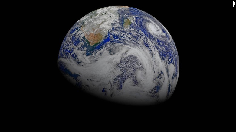
"Data from six orbits of the Suomi-NPP spacecraft have been used to create this composite of southern Africa and its surrounding oceans. You can see Tropical Cyclone Joalane swirling over the Indian Ocean, as seen on April 9, 2015."
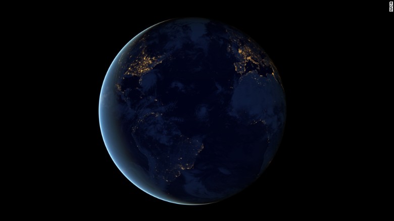
This global view of Earth's city lights is a composite assembled from data acquired by the Suomi National Polar-orbiting Partnership (Suomi NPP) satellite. The data was acquired over nine days in April 2012 and 13 days in October 2012.
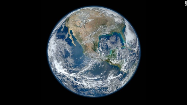
A Blue Marble image of the Earth taken from the VIIRS instrument aboard NASA's Earth-observing satellite, Suomi NPP. This composite image uses a number of swaths of the Earth's surface taken on January 4, 2012.
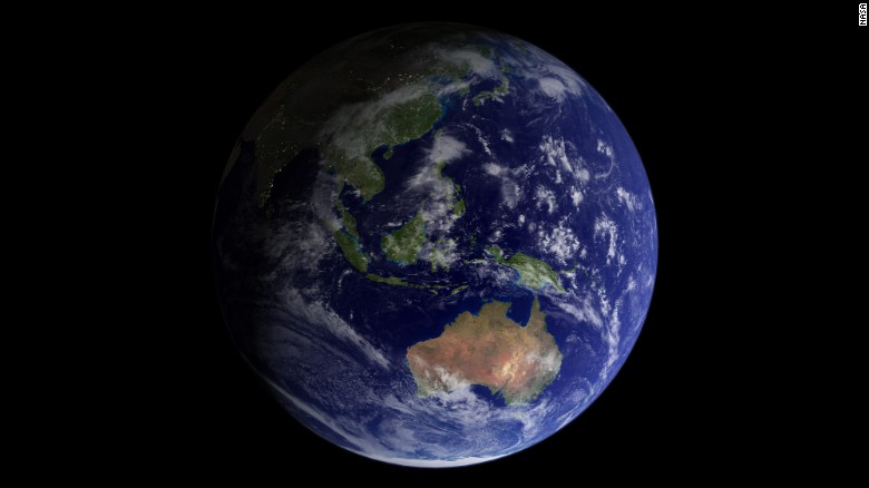
"This 2002 Blue Marble image features land surfaces, clouds, topography, and city lights at a maximum resolution of one kilometer per pixel. "

The information used to create this image came from a single remote-sensing device: NASA's Moderate Resolution Imaging Spectroradiometer, or MODIS. From 700 kilometers (430 miles) above the Earth on board the Terra satellite, MODIS provides an integrated tool for observing a variety of terrestrial, oceanic, and atmospheric features of the Earth. The land and coastal ocean portions of these images are based on surface observations collected from June through September 2001 and combined, or composited, every eight days to compensate for clouds that might block the sensor's view of the surface on any single day.
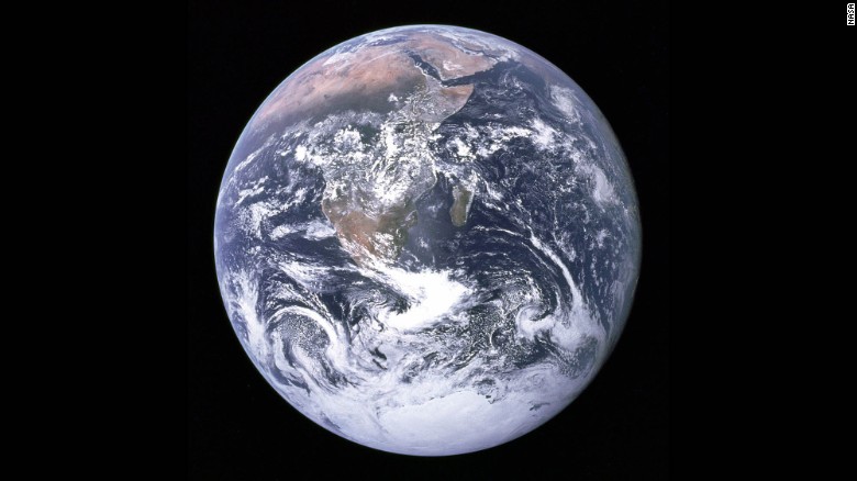
"The Blue Marble" is a famous photograph of the Earth taken on December 7, 1972, by the crew of the Apollo 17 spacecraft en route to the Moon at a distance of about 29,000 kilometers (18,000 miles). It shows Africa, Antarctica, and the Arabian Peninsula.
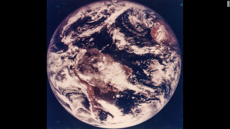
The first color photograph of Earth was captured on November 10, 1967, five years before the astronauts of Apollo 17 could witness it with their own eyes.